Discovering Namibia means diving into the heart of a country where nature imposes its rhythm and beauty. From its glowing dunes to the vast wilderness of Etosha, this southern African territory offers a unique experience. This guide dedicated to the map of Namibia will help you prepare for a trip rich in spectacular landscapes, memorable safaris and immersion in Namibian culture.
Locating Namibia: an introduction to its geography and borders
For any traveler wanting to master their itinerary, understanding where Namibia is located on the world map is essential. Bordered to the west by the Atlantic Ocean, it shares its borders with South Africa to the south, Botswana to the east, Angola to the north and Zambia to the northeast. This strategic position in southern Africa offers a fascinating mix of climates and reliefs, ranging from desert beaches to high plateaus.

Understand the physical map: relief, climates and main natural landmarks
Physical maps of Namibia reveal a striking contrast between its vast expanses of desert and its mountainous formations. The Namib desert, one of the oldest in the world, covers a large part of the country with its emblematic red dunes like the famous Dune 45. Towards the northwest, the Brandberg massif rises, while the Waterberg plateau offers more rugged terrain. These maps will help you anticipate climatic conditions, as Namibia oscillates between arid zones and more temperate regions to the northeast, where biodiversity flourishes.
Tourist map of Namibia: guide your discovery of the must-see sites
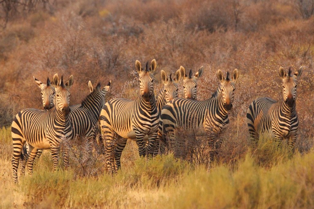
A successful trip to Namibia requires good mastery of the tourist map. It highlights national parks, major natural sites and cultural centers. Etosha National Park, a sanctuary for African wildlife, allows you to observe emblematic species such as desert elephants or black rhinoceroses in their natural habitat. The Skeleton Coast, with its mysterious wrecks, fascinates lovers of history and raw seascapes. Damaraland invites you to discover ancient cave paintings and spectacular rock formations.
Plan a route via the road map: main roads and adventure trails
Namibia is wonderful for a road trip. Its road map guides you through major cities such as Windhoek, the capital, Swakopmund, and Walvis Bay. Most of the main roads are well maintained, but you should bring an all-terrain vehicle to venture into wilder regions like Kaokoland or Damaraland. This type of map is essential for organizing your supplies and anticipating more demanding trails, while guaranteeing peace of mind and freedom on the road.
Discover the regions of Namibia: cultural and administrative diversity on the map
Namibia is divided into 14 regions, each providing a particular insight into Namibian culture and the geographical fabric of the country. Khomas hosts the capital and is the active administrative center. Erongo, with its coastal towns, combines urban life and wild nature, while Kunene amazes with its mountainous landscapes and the presence of the Himba, a nomadic people with preserved ancestral traditions. Further north-east, Zambezi is a real adventure, teeming with lush biodiversity in the Caprivi Strip.
The climate map to better prepare your stay according to the seasons
Relying on a climate map in Namibia allows you to adapt your stay to meteorological realities. The southern winter, between May and September, is ideal for safaris: temperatures are mild during the day and animals gather around watering holes. On the other hand, the rainy season, from November to March, brings sometimes violent storms and green landscapes. This knowledge will help you choose the right time to observe wildlife or enjoy the hiking trails in the Namib Desert.