Explore Botswana’s major cities through a detailed map
Viewing a map of Botswana provides a clear view of major population centers such as Gaborone, Francistown and Maun. These dynamic cities represent ideal starting points for discovering the cultural and historical richness of the country. In 2026, their infrastructure continues to develop, facilitating travel between tourist sites and rural areas. With an accurate map, travelers can organize their journeys efficiently, avoiding less accessible areas and taking full advantage of each stage.

The cultural and economic assets of Gaborone, Francistown and Maun
Gaborone, administrative capital, concentrates intense economic activity, particularly around its shopping centers and cultural institutions. Francistown, older, seduces with its mining history and its lively markets. Maun, the gateway to the Okavango Delta, attracts nature and safari enthusiasts. These cities, well represented on an updated geographic map, form an effective network for urban and natural explorations. To walk their streets in 2026 is to immerse yourself in a mosaic of traditions and modernity.
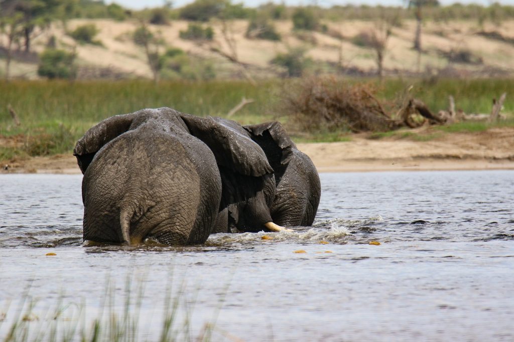
Botswana National Parks Map: Immerse yourself in wildlife and wilderness
Botswana is recognized worldwide for its exceptional national parks. The map of the country precisely details reserves like Chobe Park and the Okavango Delta, two jewels of African biodiversity. These protected areas, where wildlife thrives in an unspoilt environment, offer spectacular safaris and boat trips. In 2026, the focus is on sustainable tourism, allowing visitors to enjoy an authentic experience while minimizing their ecological impact.
Plan your safaris using a precise map of the parks
A detailed map helps identify safari trails, prime viewing areas and lodges located in the privacy of the reserves. Travelers can therefore organize itineraries perfectly suited to their desires, whether it is observing the herds of elephants in Chobe or exploring the canals of the Okavango Delta by mokoro. The complex geography of these parks requires prior scouting to ensure safety and maximize encounters with local wildlife.
Discover the desert landscapes of the Kalahari with a multifunctional map
The Kalahari Desert, located in southeastern Botswana, extends for hundreds of kilometers and reveals a universe that is both hostile and fascinating. Thanks to a precise topographical map, the dunes, savannahs and water points essential to survival in this arid region are clearly identifiable. In 2026, explorers can plan environmentally friendly expeditions while enjoying the unique panoramas offered by this wild space.
The importance of maps for safe exploration of the Kalahari
Crossing the Kalahari without preparation would be unwise. A detailed map provides information on the location of isolated villages and oases, essential for refueling and resting. The marked trails facilitate visits to traditional sites of the San people, true guardians of this desert. With these tools, each adventure is transformed into an enriching discovery, combining respect for the natural environment and cultural immersion.
Tourist mapping of Botswana: essential routes for memorable adventures
The map of Botswana is a crucial tool for structuring an effective tourist itinerary. It highlights the main routes connecting major attractions, such as routes between the Okavango Delta, Chobe Park and desert areas. These routes facilitate the adaptation of visits according to the seasons, making it possible to optimize the encounter with wildlife and the discovery of the spectacular landscapes of the country.
Optimize each step with an interactive and detailed map
Beyond roads, modern maps include traditional villages, cultural sites and secure camping spots. The use of interactive versions, now widely distributed in 2026, enriches the experience by offering real-time updates on access conditions or local events. Whether for a safari, a hike or a cultural immersion, they guide each traveler towards a perfectly adapted and secure adventure.
Botswana’s aquatic geography: locate lakes, rivers and waterways to fully explore
Botswana is also distinguished by its rich aquatic environments, notably the famous Okavango Delta. A detailed map reveals all the lakes, rivers and wetlands, essential to local biodiversity and tourist activities. The indicated waterways facilitate canoeing, fishing and ornithological excursions, offering another dimension to the discovery of the country.
Using the map for safe and responsible aquatic experiences
Cartographic precision makes it possible to identify the best navigation areas and access points for boats, while signaling fragile habitats to be preserved. In 2026, this geographical knowledge is essential for tourist operators and visitors wishing to combine adventure and respect for the ecosystem. The Okavango Delta, a true oasis in the heart of Botswana, is therefore accessible with complete peace of mind thanks to this valuable information.